
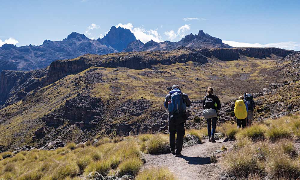
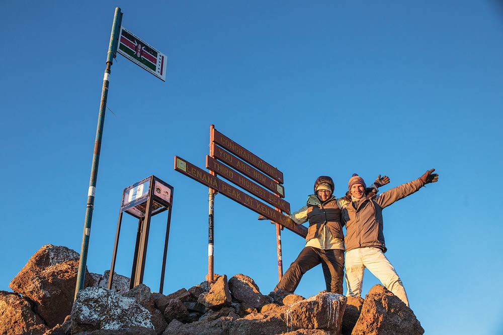
Thousands of people enjoy climbing or trekking up Mount Kenya every year. Most reach only Point Lenana (4,985 m) because to go higher requires more advanced climbing skills. Some people make the summit in 3 days, others in 4-5 days: it all depends on the route and the degree of altitude acclimatization required. All agree, however, that for variety of landscape, wildlife, views and just sheer exhilaration – it’s one of the world’s most stunning climbs. Here we give an overview of the three most popular routes to Point Lenana.
About Mount Kenya
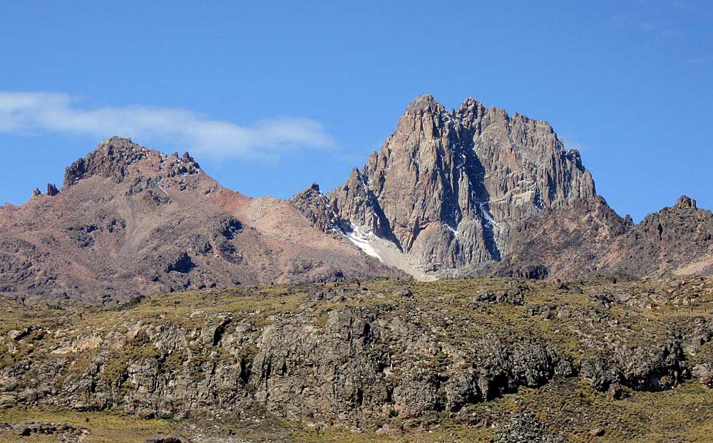
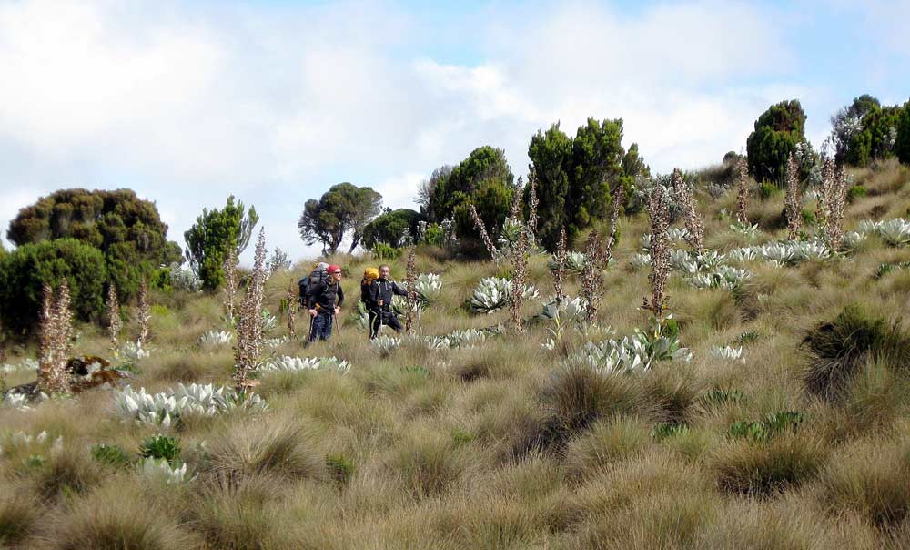
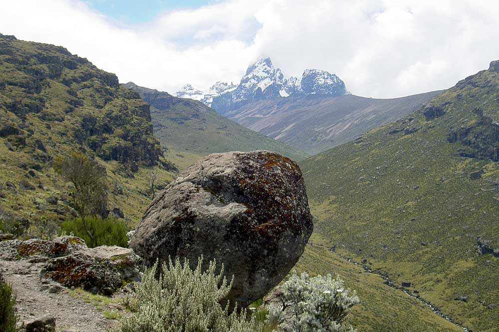
Mount Kenya is the second highest mountain in Africa and its stunning natural wilderness and forest has been inscribed as a UNESCO World Heritage site. The mountain is an ancient extinct volcano, last thought to have been active around 2.6 million years ago. There are 12 remnant glaciers on the mountain, though all are receding rapidly. On the lower slopes, the mountain comprises dense bamboo and rainforest changing to Afro-Alpine moorland at higher elevations.
Climbing Mount Kenya
Mount Kenya’s highest peak is Batian (5,199m), followed by Nelion (5,188m) and Point Lenana (4,985m). Batian and Nelion require technical climbing skills but Point Lenana is a trekkers peak, which can be reached in 3-5 days depending on the route. However, a reasonable level of fitness is still required: one should be comfortable walking for 6-8 hours per day. And trekkers should also ensure they allow adequate time to adopt a sensible pace and avoid acute mountain sickness.
Naro Moru Route
This is probably the most popular route, being the shortest up the mountain – it can be ascended in 3 days. Many guests base themselves at the popular Naro Moru River Lodge.
The Park entrance (2,400m) is 17km from Naro Moru town, to the west of the mountain. From the entrance, a paved road leads to the Met Station (3,050m) where the trek begins. (It is recommended that trekkers who are not used to high altitude should spend the first day walking from the Park entrance to the Met Station, rather than driving, in order to acclimatize.)
From the Met Station, you reach a steep, marshy section known as the “vertical bog”. The route continues through open moorland to the crest of a ridge overlooking the Teleki Valley, then descends to the valley floor and up again to Mackinder’s Camp (4,200m). The trekking time from the Met Station is approximately 5-6 hours. Usually an acclimatization day follows.
The next part of the journey is a steep, winding route on loose ground to reach the Austrian Hut, or Top Hut (4,790m) at the foot of the Lewis Glacier. It is then onward to Point Lenana, with the added excitement of a ‘via ferrata’ – or fixed lines – to help you scamble up the summit ridge.
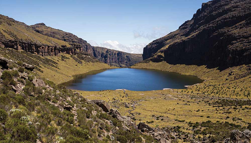
The Chogoria Route
The Chogoria route is widely regarded as the most picturesque of the routes up the mountain with several lakes and tarns to explore. There are no huts however, so trekkers and climbers need to be prepared for camping. It is also a longer route than Naro Moru, usually taking 5 days in total.
The route sets off from Chogoria town, to the east of the mountain. From here it is a 30km drive to the Park entrance (3,000m). Accommodation is available at the Meru Mount Kenya Lodge.
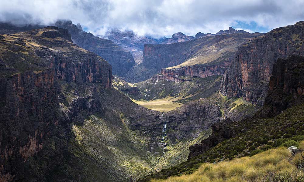
The path continues through giant heather and forest to Chogoria Road Head (3,300m) and then across the north side of the Gorges Valley to Hall Tarns (4,230m), offering spectacular views over the valley and Lake Michaelson. The hiking time from Chogoria Gate to Hall Tarns is approximately 6-9 hours.
The path from Hall Tarns continues past the Simba Tarn and Harris Tarn to Point Lenana (4-5 hours).
The Sirimon Route
The Sirimon Route approaches from the north and is another walking route that reaches Point Lenana. It is probably the easiest of the three routes and also offers spectacular scenery. It usually takes 5 days.
From the park gate, a road leads to Old Moses Hut and Judmaier Camp (3,350m). The track then climbs 300m to a communications station and then crosses moorland and ridges, dropping down to the Liki North River and then up a ridge to the Mackinder Valley. The path continues to Shipton’s Cave and then climbs steeply to Shipton’s Camp (4,250m). The route then ascends to Harris Tarn from where Point Lenana is reached.
Getting down
Having reached Point Lenana and taken in the views, there are various options for a descent route: the stunning Chogoria route is popular, but quicker descents can be made on the Sirimon route or the Naro Moru route.
Climbing Mount Kenya – more information
For information on climbing routes, visit the Mountain Club of Kenya website: www.mck.or.ke
Note: the MCK is a members-run, non-profit club and does not offer guiding services directly.
© 2024 Kenya Holidays